Siskiyou Mountain Range

The Blog

Clean Slate Timber Sale: Old-Growth Forests and Northern Spotted Owl Habitat Targeted for Removal

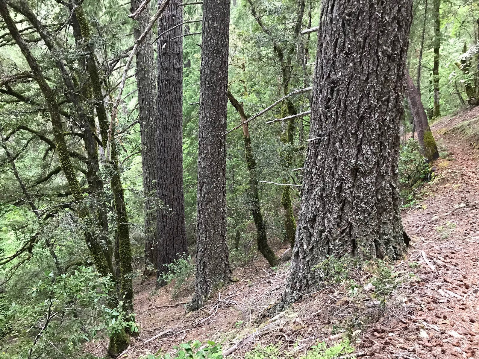
Unit 3-11 of the Clean Slate Timber Sale contains uncut, old-growth forest on fragile soils. The unit would be logged to between 25%-35% canopy cover and Northern spotted owl habitat would be removed. Throughout 2017, local residents organized and worked hard to shut down the southwestern portion of Grants Pass BLM’s Pickett West Timber Sale outside Selma, Oregon on Deer Creek. This portion of the Pickett West Timber Sale proposed to log over 1,500 acres of old forest habitat and was withdrawn due to significant public opposition, effective community organizing and unacceptable impacts to the red tree vole, a preferred prey species of the threatened Northern spotted owl. Although this was a significant victory, many of us knew it was not the last struggle over ancient forest habitat in the Deer Creek Valley. Portions of the Deer Creek Watershed have been identified as “Timber Harvest Landbase” in the BLM’s 2016 Resource Management Plan (RMP),...

Continue reading

The Upper Briggs Restoration Project: Old forest logging proposed on Briggs Creek! Please comment now!

Old-growth forest proposed for logging in the Upper Briggs Restoration Project on the Secret Way Trail, south of Sam Brown Campground. Upper Briggs Restoration Project: Old forest logging proposed on Briggs Creek! Please comment now, the comment period ends May 31st! Briggs Creek is a beautiful stream flowing south into the Illinois River canyon from its headwaters near Onion Mountain Lookout, Taylor Mountain, and to the west, Chrome Ridge. The region contains steep forested slopes, gentle green meadows at Briggs Valley, serpentine ridges, and clear flowing streams. Briggs Creek is an important cold water tributary of the Illinois River with runs of coho salmon and steelhead trout. It is also an important recreation area just west of Grants Pass, Oregon with the world’s tallest ponderosa pine trees. The region has a rich human history of indigenous land management, and later, of mining, logging, ranching and recreation. The creek is named for George Briggs who...

Continue reading

The Wellington Butte Roadless Area: A Wilderness at Our Backdoor

A view down the Balls Branch of Humbug Creek into the Applegate Valley. The Wellington Butte Roadless Area is one of the most wild, spectacular, and threatened landscapes in the foothills of the Applegate Valley. It is also perhaps the most accessible wildland in the Applegate Watershed, with immense conservation and recreational opportunities The region contains a diverse mosaic of plant communities, including sweeping grasslands, dense chaparral, sunlit oak woodlands, intact conifer forests and beautiful, mixed-hardwood stands dominated by madrone. A flush of annual lupine blooming at the headwaters of the Balls Branch of Humbug Creek. Spring has arrived in the Wellington Butte Roadless Area, and the slopes are currently ablaze with the colors of spring, buzzing with busy bees, fluttering butterflies, pollinating flies and beetles. Song birds chirp and sing, happily foraging for insects and seeds on the steep mountain slopes and in the brushy chaparral. Deer...

Continue reading

Proposed Logging Along the PCT at Cook and Green Pass!

Proposed logging along the PCT at Cook and Green Pass. The hiker at the right-hand side of the photograph is hiking the PCT, and the Klamath National Forest is proposing to log directly into the trail corridor. Trees marked blue would be logged. The Klamath National Forest has proposed a large, post-fire logging project in the 2017 Abney Fire footprint. The project would log over 1,200 acres of fire-affected forest in the region surrounding Cook and Green Pass. The project also proposes post-fire logging directly adjacent to the Pacific Crest Trail (PCT) and along the Bee Camp Road (47N80) in the Kangaroo Inventoried Roadless Area.  Cook and Green Pass is the gateway to the Red Buttes Wilderness Area, the Kangaroo Inventoried Roadless Area and the Condrey Mountain Roadless Area, it is also located within a major connectivity corridor necessary for the dispersal of wildlife and native vegetation in the region — connecting the Marble Mountains and Klamath River...

Continue reading

Miller Complex Fire Report: Mixed Severity Fire on the Siskiyou Crest

The Abney Fire burned through large portions of the Condrey Mountain and Kangaroo Inventoried Roadless Areas on the Siskiyou Crest in 2017. Miller Complex Fire Report The Klamath Forest Alliance has released the Miller Complex Fire Report, a detailed exploration of the Miller Complex Fire, its ecological implications, fire severity, and fire suppression impacts.  The Miller Complex began on August 13, 2017 with a spectacular thunderstorm. Lightning crashed down throughout the Upper Applegate watershed, igniting 27 fires from the high country on the Siskiyou Crest to the low-elevation foothills of the Upper Applegate Valley. Four major blazes burned throughout the summer, including the Burnt Peak Fire, Creedence Fire, Abney Fire and Knox Fire.  The fires burned in a healthy, mixed-severity fire mosaic, rejuvenating fire dependent plant communities, maintaining many late successional habitats, reducing fuel and restoring the process of fire to over 36,000...

Continue reading